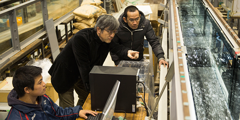
I am Mohammad Bagus Adityawan from Indonesia. I am currently a researcher at Environmental Hydrodynamics Laboratory, Tohoku University, led by Professor Hitoshi Tanaka. I obtained my Ph.D. on 2011 from Tohoku University on the solitary wave boundary layer[1]. The university is deeply involved in many studies concerning the Tsunami of 2011. There are various research activities, covering many aspects of the tsunami, such as tsunami prediction, mitigation and recovery process. Tohoku University has a close relationship with many organizations and government as to the Great East Japan Tsunami of 2011. Hence, we have the opportunity to acquire data on the 2011 event from varied sources. In addition, the laboratory is also well equipped with various instruments and devices for conducting experiments. The tsunami wave is closely related to my field and therefore, I decided to continue to work and conduct research on the 2011 Tsunami in the same laboratory after graduation.
We have reported in details the incoming tsunami wave in the 2011 event from video recordings. The tsunami celerity and the arrival time of the 2011 Tsunami at the Sendai Coast were estimated[2]. We investigated in details the effect of the 2011 Tsunami to the sand spit around the river mouth in Nanakita River. Based on our results, we proposed a new method to assess the sand spit recovery at the river mouth based on water level data and satellite images[3]. Additionally, we investigated and reported in detail on the wave propagation in the rivers induced by the 2011 Tsunami. An empirical relation was proposed to estimate the intrusion length[4]. We also used bathymetry and water level data to estimate the seabed subsidence at Ishinomaki Coast. Moreover, we studied in detail the effect of coastal embankment on the tsunami. We conducted numerical and physical experiments on the flow structure around the coastal embankment during a tsunami event[5]. Based on the results, we proposed a new method to enhance the strength of the embankment to prevent failures during a tsunami event. This research has provided useful and applicable results in practical application for researchers and engineers, as well as for decision makers.
Recently, we are conducting both numerical and laboratory experiments on the tsunami wave intrusion and sediment transport in Kitakami River. The river mouth was protected by a sand spit, which was flushed during the 2011 Tsunami. A physical model of the river and surroundings was constructed. Water level data was recorded at several points along the river in the experiment. The measurements in the physical experiment were used to validate the results from numerical models. This study was conducted to have a better understanding of the tsunami effect on rivers and to develop a reliable model for this phenomenon.
References:
- Adityawan, M.B., Tanaka, H., Lin, P., Boundary layer approach in the modeling of breaking solitary wave runup, Coastal Engineering Volume 73, pp. 167–177, 2013. doi:10.1016/j.coastaleng.2012.11.005
- Adityawan, M.B., Min, R., Tanaka, H., Mano, A., Udo, K., Investigation of tsunami propagation characteristics in river and on land induced by The Great East Japan Earthquake 2011, Journal of Earthquake and Tsunami, Volume 06, 1250033 [22 pages], 2012. doi: 10.1142/S1793431112500339
- Tanaka, H., Adityawan, M.B., Mano, A., Morphological changes at the Nanakita River mouth after the Great East Japan Tsunami of 2011. Coastal Engineering, Volume 86, pp. 14-26, 2014. doi: 10.1016/j.coastaleng.2014.01.002
- Tanaka, H., Kayane, K., Adityawan, M.B., Roh, M., Farid, M., Study on the relation of river morphology and tsunami propagation in rivers, Ocean Dynamics, Volume 64(9), pp.1319-1332, 2014. doi: 10.1007/s10236-014-0749-y
- Mitobe, Y., Adityawan, M.B., Tanaka, H., Kawahara, T., Kurosawa, T., Otsushi, K., Experiments on local scour behind coastal dikes induced by tsunami overflow. Proceedings of 34th International Conference on Coastal Engineering, 2014. doi: dx.doi.org/10.9753/icce.v34.sediment.62


